The Geography of Egypt: A Complete Guide for Travelers
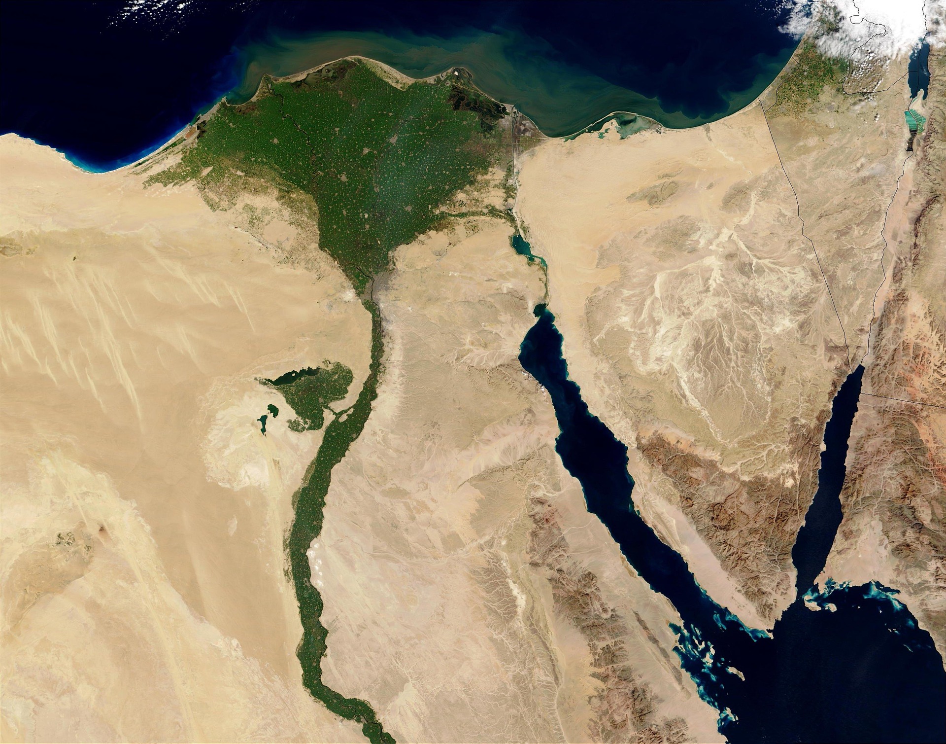
Egypt is one of the world's most fascinating countries geographically, combining vast deserts, a fertile river valley, Mediterranean and Red Sea coastlines, mountain landscapes, and the unique Sinai Peninsula. The geography of Egypt has played an important role in shaping its history, culture, agriculture, cities, and tourism.
Located in northeastern Africa, Egypt also extends into Asia through the Sinai Peninsula. Its position between Africa, Asia, the Mediterranean Sea, and the Red Sea has made Egypt an important crossroads between different regions and civilizations for thousands of years.
For travelers, understanding Egypt's geography makes it easier to plan a journey between Cairo, Luxor, Aswan, Hurghada, Sharm El Sheikh, Alexandria, and other destinations.
Where Is Egypt Located?
Egypt is located in the northeastern corner of Africa. It borders the Mediterranean Sea to the north and the Red Sea to the east. Libya lies to the west, Sudan to the south, and Israel and the Gaza Strip are located to the northeast.
The Suez Canal provides an important connection between the Mediterranean Sea and the Red Sea, making Egypt strategically important for international maritime transportation.
Egypt's location also explains why travelers can experience very different landscapes within one country—from Mediterranean beaches and fertile farmland to ancient river temples, dramatic mountains, and enormous desert areas.
The Nile River and Nile Valley
The Nile River is the most important geographical feature in Egypt. Flowing generally from south to north, the river provides water for agriculture, communities, transportation, and tourism.
Most of Egypt's population and agricultural activity are concentrated along the Nile Valley and Nile Delta because much of the country consists of arid desert.
The Nile Valley is particularly important for tourism. Cities such as Luxor and Aswan developed along the river and are home to some of Egypt's most important ancient monuments.
The Nile Delta
In northern Egypt, the Nile divides into several branches before reaching the Mediterranean Sea, creating the fertile Nile Delta.
The Delta is one of Egypt's most productive agricultural regions. Its fertile land supports crops such as wheat, rice, vegetables, fruits, and cotton.
The region is also densely populated and includes major cities such as Alexandria and many towns and villages.
Egypt's Deserts
Deserts cover most of Egypt's territory. The country's desert geography is divided primarily into the Western Desert and Eastern Desert, with the Sinai Peninsula forming another major geographical region.
The Western Desert
The Western Desert extends west of the Nile Valley toward the border with Libya. It forms part of the Sahara and contains enormous areas of sand dunes, rocky plateaus, oases, and desert depressions.
Important oases include Siwa, Bahariya, Farafra, Dakhla, and Kharga.
The Western Desert is especially attractive to travelers interested in desert adventures, oasis communities, archaeological sites, camping, and spectacular landscapes.
The Eastern Desert
The Eastern Desert lies between the Nile Valley and the Red Sea. Unlike the Western Desert, it contains extensive mountainous areas.
The region has historically been important for mining and transportation and contains ancient routes connecting the Nile Valley with the Red Sea.
Today, visitors can explore desert landscapes, mountains, monasteries, and archaeological sites in parts of the Eastern Desert.
The Sinai Peninsula
The Sinai Peninsula is geographically distinctive because it is part of Asia, while the majority of Egypt lies in Africa.
Located between the Mediterranean Sea and the Red Sea, Sinai features deserts, mountains, beaches, and coastal resorts.
Sharm El Sheikh, Dahab, and other destinations attract visitors for snorkeling, diving, beaches, desert excursions, and mountain experiences.
Mount Sinai and the surrounding mountain region are also significant destinations for travelers interested in religious and historical heritage.
The Red Sea Coast
Egypt's Red Sea coastline is one of the country's most important tourism regions. The warm waters, coral reefs, marine life, and favorable climate make destinations such as Hurghada, Marsa Alam, and Sharm El Sheikh popular with international travelers.
The Red Sea is particularly well known for scuba diving, snorkeling, boat trips, fishing, and water sports.
The coastal geography also creates a striking contrast between the blue sea and the surrounding desert mountains.
Egypt's Mediterranean Coast
Northern Egypt borders the Mediterranean Sea. Alexandria is the country's most famous Mediterranean coastal city and has played an important role in Egyptian and Mediterranean history.
The northern coast also contains numerous beaches and summer destinations, making this region particularly popular during the warmer months.
Egypt's Major Tourist Regions
Egypt's geography can make travel planning easier when destinations are grouped by region:
Region
Major Destinations
Main Attractions
Nile Valley
Cairo, Luxor, Aswan
Ancient sites, temples, museums, Nile cruises
Nile Delta
Alexandria and surrounding areas
Mediterranean coast, history, culture
Western Desert
Siwa, Bahariya, Farafra
Oases, dunes, desert landscapes
Eastern Desert
Red Sea mountains
Desert scenery, mountains, historical routes
Red Sea Coast
Hurghada, Marsa Alam
Diving, snorkeling, beaches
Sinai
Sharm El Sheikh, Dahab
Diving, beaches, mountains, desert
How Geography Shapes Travel in Egypt
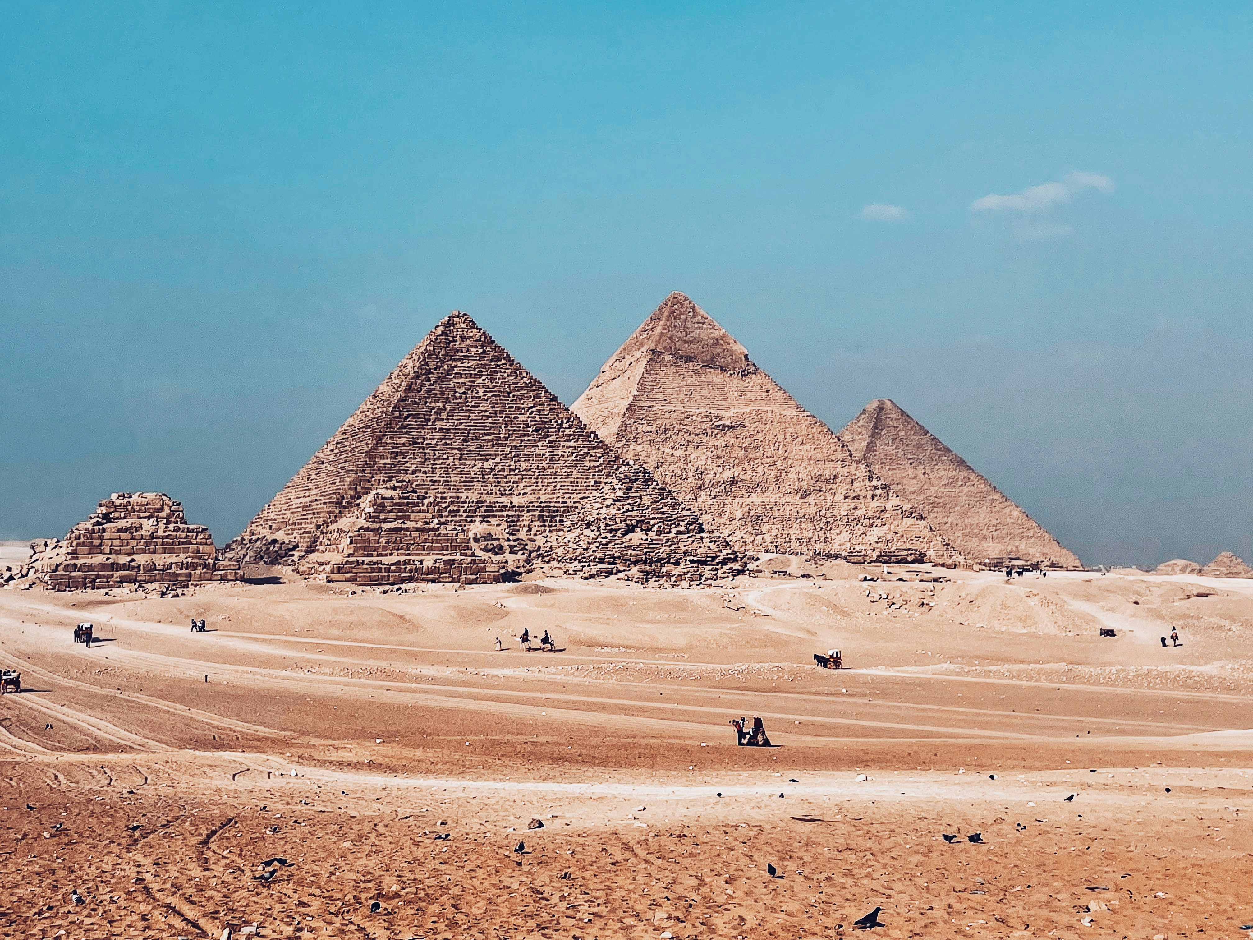
Egypt's geography means that different destinations offer very different travel experiences. A visitor can explore the pyramids and museums in Cairo, cruise between ancient temples along the Nile, relax on the Red Sea coast, or travel through the Sahara—all within the same country.
Distances between destinations can be significant, so transportation should be considered when planning an Egypt itinerary. Domestic flights can save time on longer journeys, while Nile cruises provide a convenient way to explore several historic destinations between Luxor and Aswan.
For travelers planning their first visit, combining Cairo, Luxor, Aswan, and a Red Sea destination provides an excellent geographical overview of Egypt.
Why Egypt's Geography Matters to Travelers
The geography of Egypt is much more than a map. It explains why ancient Egyptian civilization developed around the Nile, why most modern population centers are concentrated near the river, and why Egypt has such diverse tourism experiences.
From the fertile Nile Delta to the temples of Luxor, the deserts of the Sahara, the mountains of Sinai, and the coral reefs of the Red Sea, Egypt offers an extraordinary variety of landscapes within one country.
Plan Your Egypt Adventure
Ready to explore Egypt beyond the famous pyramids? Discover the country's ancient cities, Nile Valley, desert landscapes, Red Sea resorts, and historic sites with a thoughtfully planned itinerary.
Explore Egypt with a local guide and create a private journey tailored to your interests, travel dates, and preferred destinations. From Cairo and Luxor to Aswan, Abu Simbel and the Red Sea, your Egyptian adventure can be designed around the experiences you want most.
Comments
Leave a comment